


Hope Twp. Voting District, Lincoln County, Minnesota
About
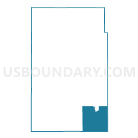
Outline

Summary
| Unique Area Identifier | 602934 |
| Name | Hope Twp. Voting District |
| County | Lincoln County |
| State | Minnesota |
| Area (square miles) | 34.82 |
| Land Area (square miles) | 34.79 |
| Water Area (square miles) | 0.03 |
| % of Land Area | 99.90 |
| % of Water Area | 0.10 |
| Latitude of the Internal Point | 44.23329900 |
| Longtitude of the Internal Point | -96.14443930 |
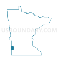
Maps

Graphs
Select a template below for downloading or customizing gragh for Hope Twp. Voting District, Lincoln County, Minnesota


Neighbors
Neighoring Voting District (by Name) Neighboring Voting District on the Map
- Aetna Twp. Voting District, Pipestone County, MN
- Coon Creek Twp. Voting District, Lyon County, MN
- Fountain Prairie Voting District, Pipestone County, MN
- Lake Benton Twp. Voting District, Lincoln County, MN
- Marshfield Twp. Voting District, Lincoln County, MN
- Shelburne Twp. Voting District, Lyon County, MN
- Tyler Voting District, Lincoln County, MN
Top 10 Neighboring County Subdivision (by Population) Neighboring County Subdivision on the Map
- Tyler city, Lincoln County, MN (1,143)
- Hope township, Lincoln County, MN (272)
- Coon Creek township, Lyon County, MN (244)
- Marshfield township, Lincoln County, MN (242)
- Lake Benton township, Lincoln County, MN (241)
- Aetna township, Pipestone County, MN (194)
- Fountain Prairie township, Pipestone County, MN (188)
- Shelburne township, Lyon County, MN (178)
Top 10 Neighboring Place (by Population) Neighboring Place on the Map
Top 10 Neighboring Unified School District (by Population) Neighboring Unified School District on the Map
Top 10 Neighboring State Legislative District Lower Chamber (by Population) Neighboring State Legislative District Lower Chamber on the Map
- State House District 21A, MN (36,793)
- State House District 22A, MN (34,781)
- State House District 20A, MN (32,187)
Top 10 Neighboring State Legislative District Upper Chamber (by Population) Neighboring State Legislative District Upper Chamber on the Map
- State Senate District 21, MN (72,185)
- State Senate District 22, MN (71,339)
- State Senate District 20, MN (66,816)
Top 10 Neighboring 111th Congressional District (by Population) Neighboring 111th Congressional District on the Map
Top 10 Neighboring Census Tract (by Population) Neighboring Census Tract on the Map
- Census Tract 3606, Lyon County, MN (2,933)
- Census Tract 2010.02, Lincoln County, MN (2,801)
- Census Tract 4601, Pipestone County, MN (1,643)